


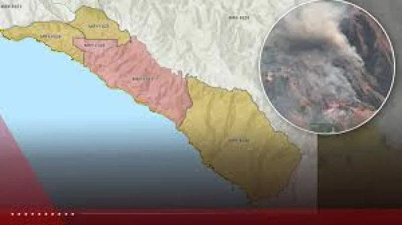
The Big Sur Fire grew to about 800 acres by Monday morning, and Monterey County Sheriff's Office issued evacuation orders for zones MRY-F026 and MRY-F027 while warnings remained in place for MRY-F024, MRY-F025 and MRY-F028.
That was a sharp jump from 400 acres at 7:25 p.m. on Sunday, and containment was still only 5% as of 5:53 a.m. on Monday. For people in the affected zones, the fire was no longer a distant line on a map but an active threat with a changing footprint.

The Timber Fire was first reported around 9:40 p.m. on Saturday in Los Padres National Forest southeast of Loma Vista, in California's Big Sur area. Officials said the fire is burning in a remote location that is difficult to access, which helps explain why crews are facing a slower response in terrain that does not give them easy roads, clear lines or quick entry points.
The fire remains highly active, and conditions can change rapidly. That warning matters because the overnight growth showed how quickly the fire can move before crews have fully boxed it in, and the cause is still under investigation.
What happens next is not a waiting game so much as a race between containment and spread. If the fire keeps moving at this pace, the evacuation map could change again before Monday is over.
