


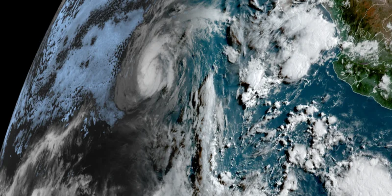
Hurricane Genevieve is churning about 500 miles off the southern tip of Baja California and is expected to drive dangerous surf toward Southern California beaches by Wednesday afternoon. The Category 4 storm is moving northwest with sustained winds of about 155 mph, and forecasters say the biggest waves will hit San Diego County beaches that face south and southwest.
Beachgoers in San Diego, Orange counties and L.A. County are being warned that the water could turn hazardous fast. In most coastal areas in San Diego and Orange counties, surf is expected to run 3 to 6 feet, with larger sets periodically reaching 7 feet, while L.A. County beaches are forecast to see heavy surf and strong rip currents.
That is why Genevieve is drawing attention now: the storm is already offshore in the Pacific, and the danger window is short. The National Weather Service says the surf and rip currents can be life-threatening, and it is urging people to check the surf forecast before picking a beach, stay off rocks and jetties, and remain near a lifeguard.

Surfline described the swell as one of the strongest hurricane swells Southern California has seen in the past decade. The warning is not just about wave height. It is about how a hurricane that remains far out over the Pacific can still turn a beach day into a rescue call when long-period swells meet local shorelines and pull water through narrow channels.
Genevieve briefly became the first Category 5 hurricane in the eastern Pacific since Kristy in 2024 early Monday, after reaching sustained winds of 160 mph, before slipping back to Category 4 strength within hours. The National Hurricane Center said the storm would keep churning northwest and west-northwest far out in the Pacific, then weaken steadily as it moves over cooler water.
So the immediate threat is not a landfall but a run of dangerous surf, especially along exposed stretches of coast. The question beach officials are now managing is whether the conditions stay in the surf zone or force local closures once the biggest sets arrive. For now, the forecast points to a sharp rise in hazard by Wednesday afternoon, and the shoreline will be the place to watch.
