


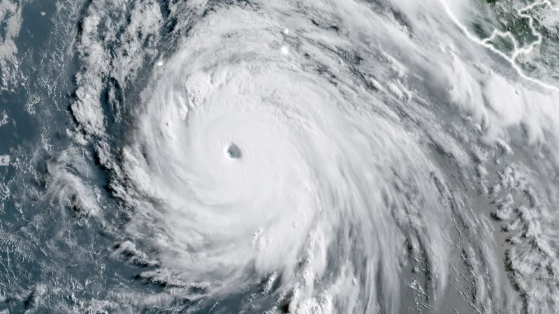
Hurricane Genevieve surged to Category 5 strength in the Eastern Pacific early Monday, becoming the basin’s first storm of that power in 2026. By 11 a.m. EDT, it had already slipped back to Category 4, even as it remained a major hurricane far south-southwest of Baja California.
The storm reached its peak at 5 a.m. EDT Monday with top sustained winds of 160 mph and a central pressure of 925 mb. That made Genevieve the planet’s fourth Category 5 tropical cyclone of 2026 and the first Eastern Pacific storm to reach that level since Kristy in 2024, a marker that landed while the system was still well away from land and not expected to threaten any land areas over the next five days.
That is what makes Genevieve stand out. It went from a tropical depression on Friday to Category 5 in barely three days, and it did so over very warm water in the tropical Eastern Pacific, where conditions were near record warmth for late July. As of late Monday morning, the storm was centered about 520 miles south-southwest of the southern tip of Baja California and moving northwest at 14 mph.

The setup that fed the burst of strengthening is also the same setup now lined up to end it. Sea surface temperatures beneath Genevieve’s path were forecast to fall below 26 degrees Celsius by Thursday, and then below 25 degrees Celsius, a level that leaves too little ocean heat to sustain a hurricane for long. At the same time, the storm was expected to move into drier air, with midlevel humidity dropping to around 50% by late week.
That is the friction in this story: Genevieve hit the top of the scale while posing no land threat, then ran into a forecast environment that should pull the strength out of it. The NOAA/NWS National Hurricane Center said the storm would steadily weaken and likely fall below hurricane strength by around Friday. In practical terms, that means the Eastern Pacific’s newest Category 5 is expected to lose hurricane status before the week is out.
Genevieve is not the only storm in the basin drawing attention. Hurricane Fausto, which was officially named on July 19 and became a hurricane on July 20 over the warm waters of the Pacific Ocean, was tracking well ahead of Genevieve on a similar path but farther south. Fausto reached Category 2 intensity by Friday morning Hawaii Standard Time and peaked at 105 mph before moving toward a track forecast to pass just north of the Hawaiian islands on Tuesday and Wednesday.
For now, Genevieve’s rise is the headline: a brief, sharp burst to Category 5, a rare milestone for the Eastern Pacific, and one that happened with no landfall risk attached. The bigger question is not whether it can intensify again, but how quickly the cooler water and dry air will strip it back down once the weakening starts.
