


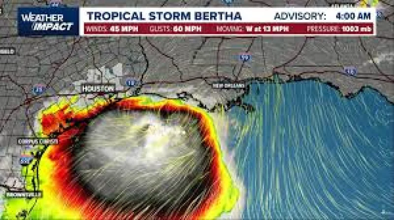
Tropical Storm Bertha made landfall in Louisiana late Wednesday and kept sliding west, prompting the National Hurricane Center to expand Tropical Storm Warnings from Cameron, Louisiana, to Sargent, Texas. At 11 p.m. ET, the storm was about 75 miles southwest of New Orleans and 135 miles east-southeast of Lake Charles, Louisiana, with 45 mph winds and a westward motion of 12 mph.
The warning line moved even as Bertha edged away from the Alabama/Mississippi border. A Tropical Storm Watch for Lake Maurepas was dropped in the same advisory, and the warning east of that border ended as forecasters focused on the Louisiana and Texas coast. The setup put the storm squarely in the path of the same shoreline now under the closest watch overnight into Thursday.
That is why the latest tropical storm Bertha weather update matters tonight: the storm was not just lingering offshore, it was being pushed toward the stretch of coast that can be hit hard by storm surge and heavy rain. The National Hurricane Center said Bertha should track westward near or along the Louisiana coast overnight before approaching the upper Texas coast on Thursday.

The storm was already leaving damage behind in Florida. Sea turtle patrol groups said storm surge washed out or inundated nests, with Alligator Point Sea Turtle Patrol saying all seven of its nests were washed over and Destin-Fort Walton Beach Sea Turtle Patrol reporting only four of its 22 nests survived. In Panama City, Florida, a Waffle House sign crashed into a parking lot during the storm.
That Florida damage shows how much water Bertha can throw around even as its center moves on. Sea turtle nests can survive being washed over, but inundation can fill the nest chamber and suffocate the eggs, which is why the difference between a flooded nest and a washed-over one matters so much.
Bertha’s 1002 mb central pressure and 45 mph winds still put it in tropical-storm territory, but the more important question now is how much water it can drive into Louisiana and the upper Texas coast before it weakens further. For coastal communities, the next move is not whether the storm is gone; it is how high the surge runs before it gets there.
