


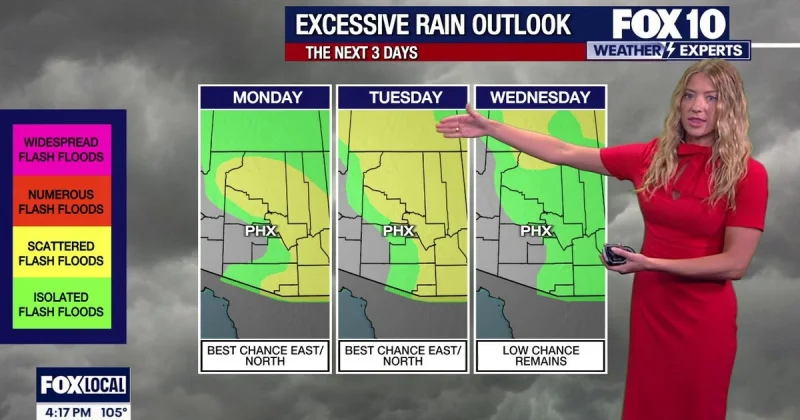
Heavy storms pushed west and southwest across Arizona on Monday evening, bringing flash flooding, quarter and half-dollar-sized hail and damaging winds as the Valley braced for storms later in the night. In Prescott Valley, intense monsoon storms already left residents cleaning up from severe weather and lingering high waters.
That is why Phoenix Weather is drawing attention now: the Valley was expected to see storms late Monday evening, with rain possible through the night and into the early Tuesday morning commute. Temperatures were expected to drop to around 85 degrees as the system moved through, offering only a brief break before the bigger shift later in the week.

The storm threat was not limited to one part of the state. A flood watch was set for Tuesday in eastern and northern Arizona because of excessive runoff as more rain fell on saturated ground, while storms were expected to pop up in the mountains and High Country Tuesday afternoon. For residents in the Valley, the setup was uneasy: mostly cloudy and mainly dry on Tuesday, then no rain expected until late Tuesday night, even though flooding, hail and wind threats were already active Monday night.
That mismatch matters because the worst of the weather did not neatly line up with the daytime forecast. People in the Valley were being asked to live with a night of possible storms, a quieter Tuesday, and the chance of more rain late Tuesday night, while other parts of Arizona dealt with runoff and cleanup at the same time. The pattern fit a monsoon stretch that had already kept last week busy with storms up and down Arizona.
The respite will not last long. Storm chances were expected to lower for the Valley from Thursday through the weekend, but temperatures were also expected to climb back into the 110s, and an extreme heat warning was set to run from Thursday to Monday for the Valley and desert. For people tracking Phoenix Weather, the immediate story is the storms; the bigger one is that the cooldown gives way quickly to dangerous heat again.
