


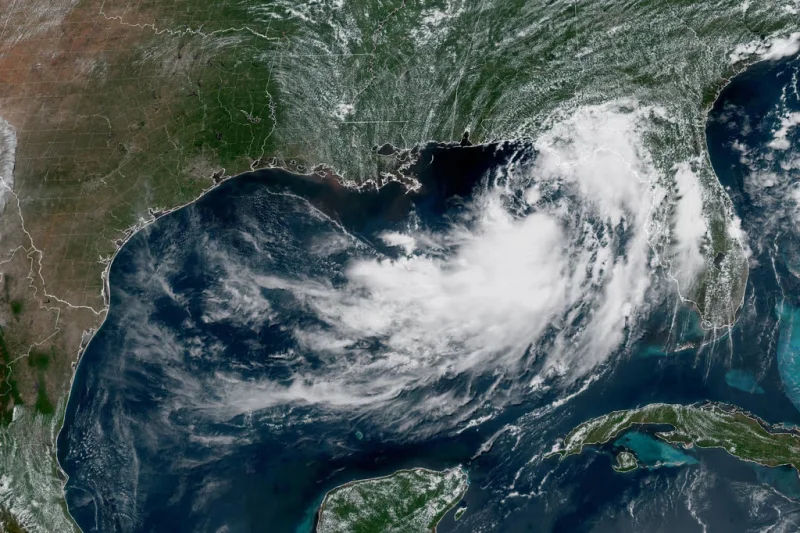
Tropical Storm Bertha formed Monday afternoon in the Gulf of Mexico and was drifting slowly west-northwest, with its center about 180 kilometers south of Panama City, Florida, by 8 p.m. ET. It had maximum sustained winds near 65 km/h and was expected to keep strengthening as it moved toward the northern Gulf Coast.
The storm’s arrival mattered immediately because it put a long stretch of shoreline under alert at once. A tropical storm warning was in effect from the río Ochlockonee in Florida to southeast Luisiana, while a storm surge warning covered the coast from the mouth of the Mississippi River to the Alabama-Florida line. Forecasters said water levels could rise by as much as 1.2 meters in parts of Louisiana and Mississippi, enough to push seawater inland even before the strongest winds arrive.
Bertha is the second tropical storm of the Atlantic hurricane season, and that timing helps explain why the concern spread so quickly. The National Hurricane Center said the system was moving at only about 6 km/h, a pace that can keep rain bands parked over the same communities for hours. Slow motion does not make a storm weaker; it often makes the rain and flooding worse, because the water keeps falling on the same places instead of moving on.

That is why the forecast extended well beyond the narrow path of the center. Meteorologists said flash flooding could develop along the coast from western Florida to central Texas through Friday, with Louisiana seeing 7 to 12 centimeters of rain. The same setup could also produce one or two isolated tornadoes this week in the Big Bend region of Florida, even though Bertha was still only a tropical storm.
The contrast is the part that matters. A system with winds of 65 km/h is not a major hurricane, but it can still bring storm surge, inland flooding and brief tornadoes when it crawls along the coast. The question now is how much stronger Bertha becomes before it reaches the shoreline and whether the slow, erratic track keeps the heaviest impacts in place long enough to force more advisories.
Bertha’s path also fits a pattern seen just weeks earlier, when Tropical Storm Arthur brought heavy rain to the southeast of Estados Unidos. Farther away in the eastern Pacific, Tropical Storm Fausto strengthened Monday and was nearing hurricane status offshore, a reminder that one basin can be quiet while another turns active at the same time.
