


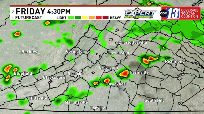
A strong storm system is moving into the region Friday evening and will keep the area on alert through Saturday, bringing heavy rain, gusty winds and the kind of storm setup that can turn quickly dangerous. The primary concern shifts after midnight, when the storms are expected to lean more toward flooding as the ground stays saturated.
Grant Dade warned that some areas could see more than three inches of rain, a level that can overwhelm low-lying spots fast when the soil is already soaked. That is why the wettest stretch matters today: it is arriving after a very rainy day marked by multiple flash flood warnings, and the next round could hit travel and drainage at the same time.
Flood Watches are in effect until Saturday night, and the most persistent rain threat is expected Friday evening through Saturday. By morning, lows will fall to the lower 70s, then scattered storms are expected to develop Saturday afternoon as temperatures reach the mid-to-upper 80s. Any stronger storm that forms then could produce damaging winds, while low-lying areas face the greatest risk of dangerous conditions and flooding.

There is a catch in the forecast that keeps this from being a quick clean-out. A quieter weather pattern is expected Sunday, but not before late Saturday's front and the flooding concern have had their chance to work through the region. A few showers can still linger Sunday, even as highs reach the middle 80s.
For people in low-lying areas and anyone who has to drive through the rain, the key point is simple: the worst of the flooding threat runs through Saturday night, and the storm system does not fully let up until Sunday. After that, conditions turn drier next week with hotter temperatures on the way.
