


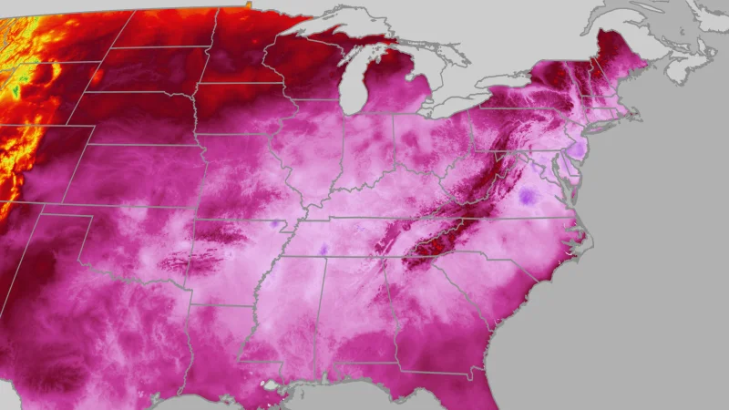
A major heat wave kept dangerous heat and humidity locked over the Eastern United States through the Fourth of July weekend, leaving more than 165 million Americans at risk of major or extreme heat-related health issues. The heat dome stretched from the Plains to the East and brought triple-digit heat indices, with little overnight relief in some places.
The search around Weather.com makes sense because the heat was not easing by the holiday itself. From Washington, D.C. to the Carolinas, heat indices could top 100 degrees through Sunday, while highs in the South were expected to stay mostly in the 90s with heat indices above 100 degrees for millions.
The National Weather Service experimental HeatRisk product put the scale of the threat into sharp relief: it covered Americans in the Midwest and East, a broad swath that includes the Midwestern core and much of the Atlantic side of the country. Some places saw daily lows stay in the mid-80s, which meant the heat never really let up after sunset.

Record warm lows made the danger easier to see. On Tuesday, La Crosse, Wisconsin, tied its all-time warmest low at 81 degrees, a mark that dates back to 1872 and had most recently been matched on July 4, 2012. Rockford, Illinois, Louisville, Kentucky and Topeka, Kansas also set or tied record warm lows, while Dallas had an 81-degree low on Monday, matching a record set two years ago.
That heat did not hit every region in the same way. Alerts had dropped for the Ohio Valley and South, even as they stayed in place for the East Coast and pockets of the Southeast, where the worst conditions were still expected to linger.
The break may come only slowly. A little more relief could reach the mid-Atlantic states by Monday or Tuesday as the heat dome shifts westward, but the danger across the East Coast does not disappear on the holiday calendar. It eases only when the dome moves.
