


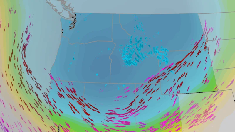
The National Weather Service updated its winter storm warning and winter weather advisory for the Idaho, Montana and Wyoming border region on Saturday, putting backcountry and higher-elevation travel on notice as heavy snow, wind and cold moved in. The warning runs through Monday night, but the storm itself is expected to keep working on the region from Saturday night through Tuesday.
The biggest snowfall forecast is in the Georgetown Lake region, where as much as three feet of snow could fall. Farther west, 4th of July Peak in Idaho was expected to get around a foot, while Pitchstone Plateau in Wyoming was forecast for eight inches. That spread is what makes the storm more uneven than it first sounds: higher terrain can squeeze more snow out of the same system, while slightly lower or drier pockets end up with less.
Even the lower totals are enough to make travel dangerous when the wind starts pushing it around. The National Weather Service said significant 55 mph winds could create travel problems, and those winds matter as much as the snow itself because they reduce visibility, drift snow into roads and make exposed stretches feel colder and more punishing. The agency told people to consider delaying travel across the backcountry and higher elevations and, if travel is unavoidable, to carry a winter storm kit, tire chains, booster cables, a flashlight, a shovel, blankets, extra clothing, water and a first aid kit.

Near the Beartooth Mountains, snow was expected to lighten or stop for a time Sunday afternoon into Sunday evening before redeveloping Sunday night and continuing into Monday and Tuesday morning. That pause does not mean the threat is gone; it means the storm is likely to pulse, which can lull travelers into moving when conditions are about to turn worse again. The National Weather Service also warned that cold temperatures, wind and wet snow could raise the risk of hypothermia and bring down trees, blocking access to backcountry roadways.
The timing is awkward for the region because the system is arriving just as many people are preparing for the fourth of July holiday. Heavy wet snow is hard enough to deal with in midwinter. It is more disruptive when it lands on backcountry routes and higher elevations at the start of a holiday week, with road access uncertain and the most exposed areas likely to take the brunt of the storm. The question now is not whether the weather will be difficult, but how much of the warned area will end up under the highest totals before the system moves on Tuesday.
For travelers, the practical answer is simple: the warning is already in place, the worst conditions are aimed at the highest ground, and the safest plan is to stay put unless the trip cannot wait.
