


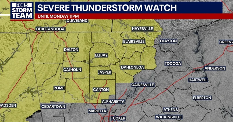
Much of North Georgia was under a severe thunderstorm watch Monday night, with the National Weather Service warning that damaging straight-line winds, torrential rain and localized flash flooding could hit before the watch expired at 11 p.m. Monday.
The watch covered Bartow, Catoosa, Chattooga, Cherokee, Dade, Dawson, Fannin, Floyd, Gilmer, Gordon, Lumpkin, Murray, Pickens, Towns, Union, Walker, White and Whitfield counties, and it stretched as far east as Union, Towns, Habersham and White. That meant residents in a broad swath of the region were spending the evening under a level 2 out of 5 severe weather threat, a risk level that signals scattered severe storms are possible but not widespread enough to suggest the kind of all-night, all-area outbreak that drives the highest alerts.

FOX 5 Storm Team Meteorologist Johnathan Stacey said the skies would flare up again around 10 o'clock and that the metro area would get in on the action later in the night as a line moved in after dark. Most areas in the storm path could pick up a quick half-inch to three-quarters of an inch of rain, but training storms could push higher totals in isolated pockets, which is where flash flooding becomes the problem fast.
The main concern was the wind. Intense straight-line gusts could knock down tree limbs, snap power lines and leave some neighborhoods with isolated outages, and a brief tornado could not be completely ruled out in the far northwestern corner of Georgia. That is the gap in any watch like this: one line of storms can stay routine for most people and still do damage where it slows or repeats over the same place.
The line was expected to keep moving east and lose strength in the early morning hours on Tuesday, leaving behind a drier, more comfortable airmass over North Georgia. For anyone in the watch area, the useful part of the forecast was simple enough: the threat was real Monday night, but it was also moving on by daybreak.
