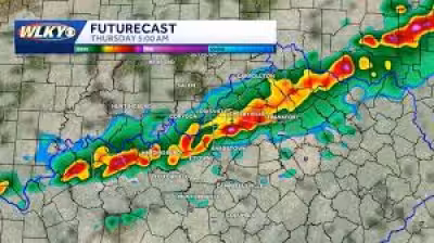
Severe storms were threatening the Midwest on Wednesday night, and the difference between tornado watch and warning mattered in a hurry: the watch stayed in effect until 1 A.M. EDT, while warnings were being issued where tornadoes had already been spotted or confirmed. People in Illinois, Iowa, Indiana and around Indianapolis and St. Louis were watching a storm system that could bring strong tornadoes, 80 mph gusts and hail up to 2.5 inches across the region.
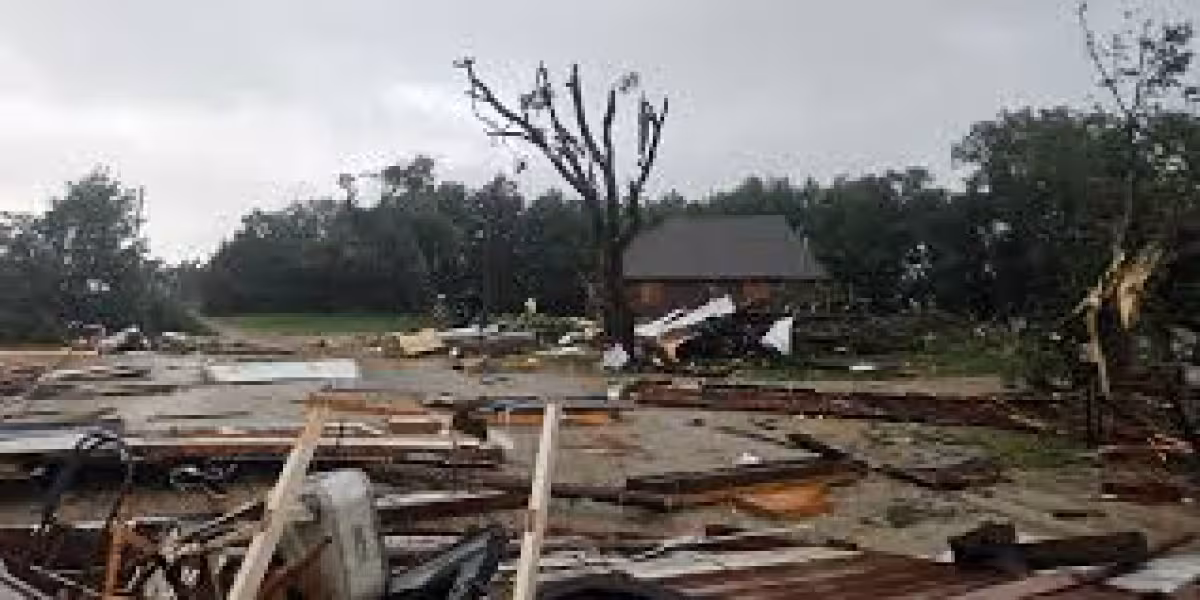
The search for that distinction is driven by what was happening on the ground. A confirmed large and dangerous tornado had already triggered a warning near Harpers Ferry, Iowa, earlier in the evening, and another confirmed large and extremely dangerous tornado was spotted near Charleston, Illinois, moving east at 45 mph. The National Weather Service in La Cross, Wisconsin, planned to send a survey team to areas near Harpers Ferry, Iowa, after the storms passed.
A watch means conditions are favorable for tornadoes, so people need to be ready to act. A warning means a tornado is either seen or indicated by radar, so the response should be immediate. That was the practical divide as the cluster of storms in Illinois pushed toward Indiana through 10 P.M., with the tornado threat increasing for I-70 and severe storms expected to move into Indianapolis and St. Louis in the next hour.
What made the evening unusual was that the danger was not fading after dark. Severe storms often weaken once the sun goes down, but conditions were so favorable that the tornado threat could last well into the overnight hours. That left places such as Loxa, Coles County Airport and Fox Ridge State Park inside the path of a tornado-producing storm, while commuters on Interstate 57 between mile markers 187 and 196 were also in the line of danger.
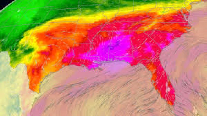
The Midwest storm system was unfolding at the same time Arthur was driving a separate flood threat in the South. Some cities there had already seen more than 6 inches of rain Tuesday, and areas across the region could get another 20 inches before Arthur was done. Houston and Galveston were also headed into heat advisories from 11 am Thursday to 10 pm Friday, with heat indices above 110 degrees possible, and New Orleans could see a heat index around 110 this weekend.
The immediate question in the Midwest was not whether the weather was serious. It was whether people were acting on the warning signs quickly enough before the overnight watch turned into another round of warnings. Survey crews near Harpers Ferry will help show how much damage the storms left behind, but the bigger test was already under way: who moved when the watch became a warning.