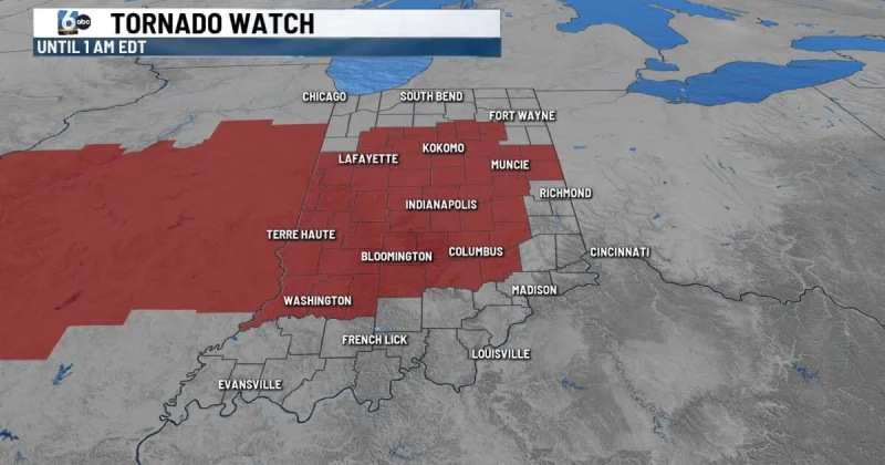
A tornado watch was issued through 1 a.m. EDT Thursday for much of Indiana, putting 47 of the state’s 92 counties under an overnight alert that includes Indianapolis and surrounding counties. The watch came as a line of supercells was expected to form in Illinois and move into central Indiana.
That is why people were searching for tornado near me late Wednesday: the threat was broad, the timing was overnight, and the warning covered a large part of the Hoosier state. In neighboring Illinois, dozens of counties were already under a tornado watch until 10 p.m. CDT, or 11 p.m. EST, showing how the system was moving east across the region.
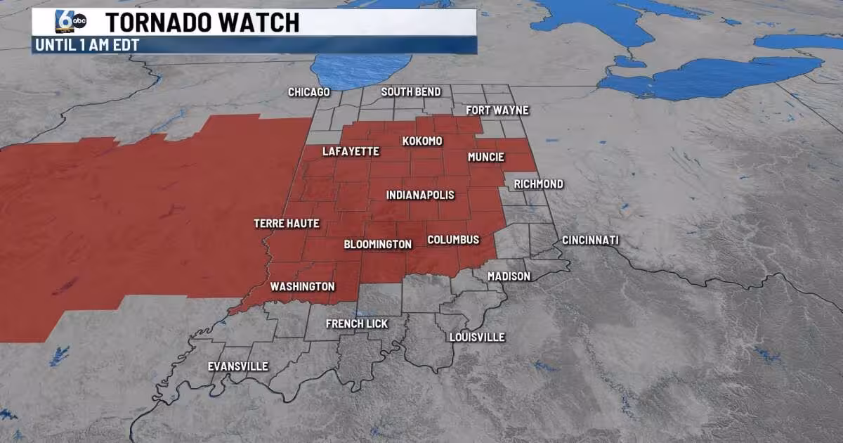
All threats of severe weather were on the table during the watch period, including damaging wind, strong tornadoes, large hail and flooding. Ryan Morse said Wednesday afternoon’s rain was the first of two rounds coming to the Hoosier state, underscoring that the evening and overnight period could bring another surge of storms.
Keith Gibson urged residents to have multiple ways to get alerts and to keep electronic devices fully charged in case they lose power. That advice mattered because severe storms were expected to exit Indiana in the early morning hours, which means the danger should not last all night even though the watch did.
The short window is the part people need to understand. The watch covers Indianapolis and nearby counties, but the worst of the system was expected to move through and leave the state before dawn, limiting how long the strongest storms could organize over Indiana. The next chance for rain after that could be Saturday.