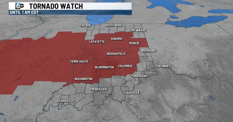
A tornado watch was issued Wednesday for 47 Indiana counties, including Indianapolis and surrounding counties, and it remains in effect through 1 a.m. EDT Thursday. The watch covers half of the storm-prone overnight period with damaging wind, strong tornadoes, large hail and flooding all on the table.
For residents in the watch area, the warning is not abstract. Ryan Morse said Wednesday afternoon's rain was only the first of two rounds coming to the Hoosier state, and a line of supercells was expected to form in Illinois before moving into central Indiana.
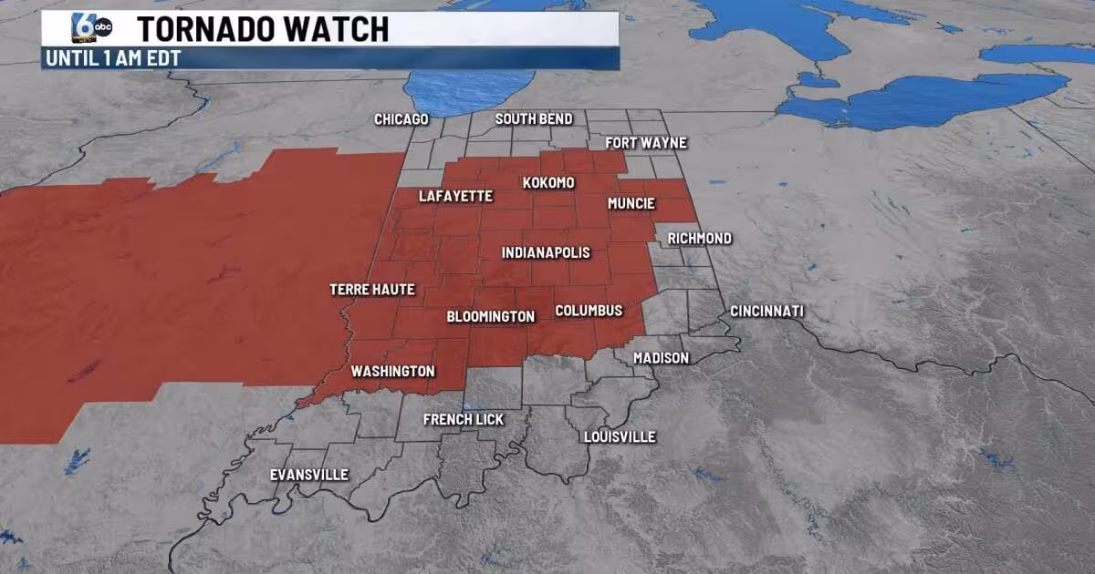
That is why the map matters. The watch spans 47 of Indiana's 92 counties, from Bartholomew and Boone to Hamilton, Marion, Monroe, Shelby, Tippecanoe and White, with Indianapolis in the middle of the forecast area. The broad reach shows how far the severe-weather setup stretches across the state, even as the worst conditions are expected to organize to the west first.
Keith Gibson said people should have multiple ways of getting alerts and keep electronic devices fully charged in case they lose power. That advice fits the shape of this storm more than the headline does: dozens of counties in Illinois were also under a tornado watch Wednesday evening, and the line was expected to cross into Indiana overnight.
There is still one useful limit to the threat. Severe storms were expected to exit Indiana in the early morning hours, which means the watch is a short fuse rather than an all-night siege. After these storms move out, the next chance for rain could come on Saturday.