


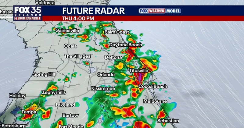
Central Florida was set for a wet, storm-filled day, with clouds building by mid-morning and quickly unloading localized downpours. Numerous storms were expected to develop this afternoon and push east across the region, turning the I-4 corridor and especially I-95 into the target zone for a slow, soggy evening commute.
The strongest storms could come as they move toward the coast, especially in Brevard, Volusia and Flagler counties. A brief strong to severe storm could not be ruled out, with gusty winds, small hail, heavy rain and frequent lightning among the main concerns. The chance for rain stood at 70 percent, and highs were expected to reach the mid-to-upper 80s.
Showers and storms were expected to gradually wind down tonight, with overnight lows settling into the 70s. But the pattern is not loosening much: another round of afternoon and evening showers and storms was expected to develop and move northwest to southeast across Central Florida.

Deep tropical moisture was expected to keep feeding the setup, leaving conditions more like August than early June. The weather pattern was not expected to be as widespread as Thursday and Friday, but it was still wet enough to soak roads, slow traffic and keep lightning in play for much of the day.
That matters because hurricane season officially begins Monday, June 1, and runs through November 30, even though no systems were forecast to form over the next 7 days. One model, the GFS, has occasionally hinted at something trying to organize, but wind shear still looked strong enough to make development difficult, slow or possibly impossible. Warm Gulf waters alone do not create a tropical storm, and for now the bigger story is plain rain, not tropical trouble.
For Central Florida, the answer today is simple: expect repeated downpours, watch for fast-changing road conditions, and plan around the heaviest rain if you are headed through the I-4 corridor or down I-95. The immediate threat is not a named system. It is a day that can turn a normal commute into a crawl.
