Residents across parts of the Midwest and Great Plains are bracing for another day of severe weather on Monday, with threats that include possible tornadoes, damaging winds and large hail. The risk is expected to stay active into Tuesday, keeping a broad stretch of the central United States under the gun.
The strongest concern on Monday runs from north-central Oklahoma into Minnesota and western Wisconsin, where forecasters say storms could turn especially active. A level 3 out of 5 enhanced risk stretches from east-central Nebraska to southwest Minnesota and includes Sioux Falls, South Dakota, and Grand Island, Nebraska, while a higher level 4 out of 5 moderate risk covers parts of central and northeast Kansas into far southeast Nebraska, including Topeka, Kansas. In those areas, large hail, destructive winds and tornadoes are possible, and more than 30 million people from the central Plains to the Midwest are expected to be on alert.
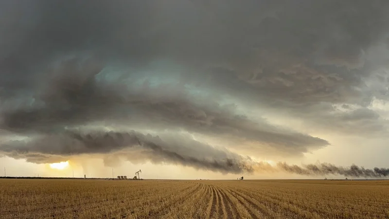
Saturday’s storms showed how quickly the pattern can turn violent. Reports of tornadoes came in from Iowa, Kansas and Nebraska, while hail the size of baseballs fell in Kansas, Missouri, Iowa and Nebraska. Thunderstorms near Concordia, Kansas, produced estimated wind gusts of 90 mph and knocked down trees and power lines, and Hill City Airport in northwest Kansas reported winds up to 82 mph. Strong winds also fueled dust storms that threatened driving conditions, adding another hazard for people on the road. For a broader look at how hail threats are building again, see Hail Storm threat returns as severe weather targets central U.S. again.
Late Saturday night, thunderstorms triggered a flash flood emergency in central Grundy County, Missouri, including the city of Trenton, after six to eight inches of rain fell in just a few hours. The wet weather came on top of a run of dangerous storms that already had delivered tornado reports, baseball-sized hail and damaging winds across the central part of the country, leaving communities to recover even as the next round approaches.
Fire danger is rising at the same time. Parts of the Plains and Southeast are expected to face critical fire weather conditions into this week because of warm, dry and windy weather, and red-flag warnings have been issued from Arizona to southern Nebraska and in California’s Central San Joaquin Valley. In Minnesota, the largest wildfire, the Flanders Fire in Crow Wing County, had burned more than 1,100 acres and was 0% contained on Sunday morning, prompting evacuation orders in Crosslake. Gov. Tim Walz declared a state of emergency and mobilized the state’s National Guard, while dozens of other wildfires broke out over the weekend across the Great Plains from Montana to the Dakotas, as well as in Texas and New Mexico over the last week.
By Tuesday, the severe weather threat is expected to spread farther east and south, with a level 2 out of 5 slight risk stretching from northeast Texas to Michigan and bringing the chance of strong to severe thunderstorms. For now, the answer to the question facing the region is blunt: the storm system is not done, and Monday is likely to be another rough day before the pattern begins to ease.