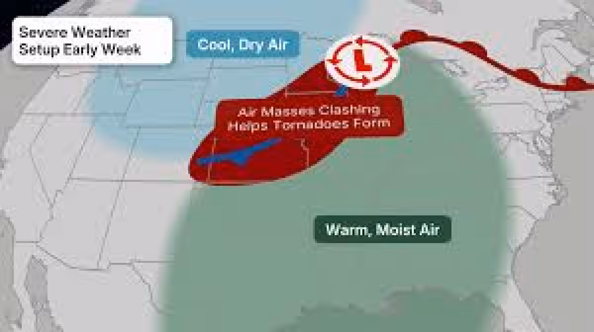
A severe weather outbreak could unfold across the Plains starting Sunday, with tornadoes, hail and damaging winds all in play as storms build in multiple rounds. NOAA's Storm Prediction Center said the threat could turn especially dangerous by Sunday evening in the Central Plains and upper Midwest, with strong tornadoes possible.
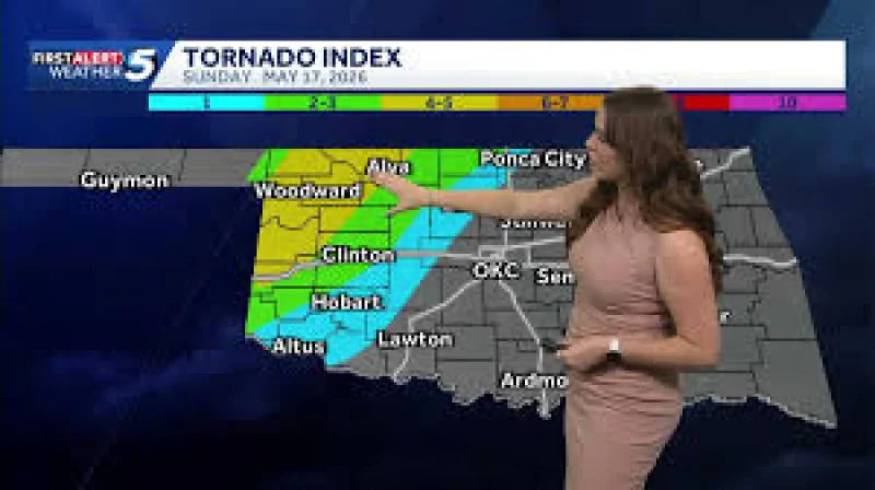
The first round may come in the morning in the upper Midwest, followed by another push in the afternoon and night from the Plains back into the upper Midwest. The most widespread threat appears to sit in the dark orange and red areas on the risk map, while Oklahoma may see relatively few severe storms. Storms forming along the dryline could become supercells capable of hail, strong winds and perhaps a tornado, a pattern that matches the growing concern outlined in this report on the storm risk building across the Plains and Midwest from Sunday.
The weight of the forecast is Monday, when the threat could become the broadest and stretch from Texas to Michigan. The area most likely to see severe weather includes Des Moines, Kansas City, Omaha and Wichita, and forecasters said strong to intense tornadoes, damaging winds, large to giant hail and flooding rain are all possible Monday and Monday evening. NOAA's Storm Prediction Center said a risk for strong to intense tornadoes is possible in parts of the Central Plains by Monday evening and that the threat may need to be increased in the coming hours.
That is a sharp escalation from the storms already on the board. On May 14, there were 39 wind reports and three large hail reports. On May 15, that jumped to 52 wind reports and 30 large hail reports. A gust reached 84 mph in Seagraves, Texas, and tennis ball sized hail, or 2.50 inches in diameter, was reported across Iowa, a reminder that this outbreak is not arriving from a blank sky but from an active severe weather pattern that is already producing damaging storms.
Tuesday could bring another round of severe thunderstorms ahead of the frontal system, this time from parts of the Southern Plains to the mid-Mississippi and Ohio Valleys, with the risk possibly reaching into the Great Lakes. Scattered severe storms may return Wednesday and Thursday in parts of the South, with the pattern potentially extending into parts of the East. May is the month with the most tornadoes in the United States on average over the past 25 years ending in 2025, and this stretch of days fits that peak season.
The question now is not whether the atmosphere is primed for a multi-day outbreak; it is how far the highest-end risk will spread once the storms organize Monday. For people in the corridor from Texas to Michigan, the storm threat is already broad enough to demand close attention before the first round arrives.