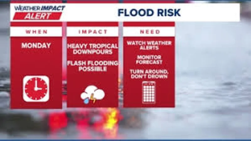
Houston weather turns wetter Monday through Tuesday, with more rain in the forecast and some flooding possible in spots. Sarah Spivey said the bottom line for San Antonio and the Texas coast is that rain chances are rising, and the forecast now points to a 40% coverage of showers.
That matters today because the change is tied to the next two days, not some distant outlook. For most people, the pattern still looks hot and humid, but there could be a rumble of thunder or two, especially in the afternoon, before the rain chance eases off after sunset.
Spivey said that while the rain threat is higher, it is still a short-term setup rather than a broad outbreak. She said this is categorically false when it comes to claims that there is a tropical system in the Gulf, adding that some social media posts, local websites and news outlets are pushing that idea as clickbait.
Instead, the National Hurricane Center is watching a messy area of disorganized storms with a lot of moisture around it in the Bay of Campeche, and it is giving that area just a 20% chance of becoming a tropical system. That low odds setup helps explain why the forecast is focused on rain and spot flooding, not on a named storm or a bigger wind event.
The unsettled pattern also fits a larger need for more rain, since the region has been dealing with drought. What comes next is simpler than the online noise: a wetter Monday through Tuesday, a few places that could flood if heavier showers set up, and continued watching of the Bay of Campeche system to see whether it stays disorganized or changes shape.