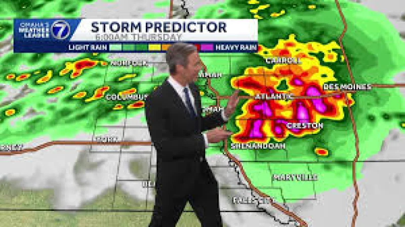
Strong storms were expected to build very early Thursday morning across the Omaha metro and into western Iowa, putting hail, damaging wind and heavy rain on the table before most people are awake. The best chance for the worst weather was before sunrise, with some storms already starting to take shape after 3 a.m. south of Interstate 80.
That timing matters because it puts the severe-weather window squarely into the overnight hours and the Thursday morning drive. Temperatures were well into the 90s across the Omaha metro Wednesday afternoon, a hot, unstable setup that helped fuel the threat. By Thursday afternoon, the forecast called for sunshine and highs near 80 degrees, but only after the storm risk had already moved through.
A Tornado Watch was in effect Wednesday evening from about Falls City through Clarinda until 9 p.m., with the best chance for storms in those areas expected before 5 p.m. The same line of weather was then expected to drift northeast overnight, with models starting to lock in on storms from I-80 to the south after 3 a.m. Once those storms form, they could bring big hail, strong winds and heavy rain, and the rain could linger through the morning drive before pushing into Iowa.
The forecast was not a clean overnight threat followed by a quick exit. Heavy rain could continue into the commute, then scattered showers could hang around until noon Thursday even as northwest winds gusted over 30 mph at times in the afternoon. That means some communities may see the storms before dawn, others during the drive to work, and a few pockets may be left dealing with water-covered roads after the stronger cells have passed.
There was also a larger weather pattern building behind the immediate threat. The forecast pointed to severe storms still being possible across parts of the Missouri River Valley on Saturday, while temperatures were expected to drop into the 70s for a couple of days after the front. Sunday was likely dry, a few isolated showers could show up Monday, and highs around 90 degrees were expected to return for the second half of next week. For now, though, the headline is the same one people in Omaha and nearby communities need to watch: the strongest storms are aimed at the hours before sunrise Thursday.