Australia’s weather is about to turn. After several quiet days under a large, slow-moving high pressure system, rain, thunderstorms, snow and potentially damaging winds are set to sweep into parts of the southeast and southwest next week.
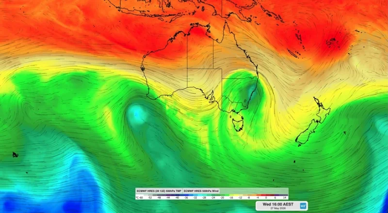
The change is being driven by two pools of cold air high in the atmosphere, and the first one will start the shift as early as Thursday, moving over southern Western Australia and South Australia before reaching southeastern Australia early to mid next week. The second system is expected to arrive in the southwest around Wednesday or Thursday next week, bringing another round of rain, wind and storms.
What makes the setup worth watching is not just that it will break the recent run of benign weather, but that it could build into a much more active period for people in the path of the first system. Rain is not expected to be especially heavy as it crosses Western Australia and South Australia later this week, but once it reaches southeastern Australia, forecast guidance points to the risk of a low pressure system forming and sharpening the weather further.

Some forecast models are already showing heavy rain developing over parts of Tasmania, Victoria and New South Wales around Tuesday and Wednesday. That same zone could also see thunderstorms, snow and blustery winds, depending on how the system evolves. The timing matters because the first upper-level cold pool will be moving through early to mid next week, and the transition from a broad upper disturbance to a surface low is often where the forecast can change fastest.
For now, the pattern is being monitored rather than treated as a confirmed severe weather event. The systems are still more than five days away, which leaves room for the details to shift, especially on rainfall totals and where the strongest winds set up. The Bureau of Meteorology is expected to issue warnings if severe weather or severe thunderstorms become likely.
That uncertainty is why weather today matters beyond the short-term forecast. A broad ridge of high pressure has kept much of the country settled over the last few days, but that calm is giving way to a more active stretch that could affect travel, farming and outdoor plans across two separate regions. For readers tracking other fast-changing conditions, the same kind of abrupt swing has been seen elsewhere too, including in stories such as London Weather Today: Hailstorm Sweeps Capital Before Summer Warmup.
The immediate question is not whether Australia will stay quiet. It will not. The question is how much moisture and how much force the incoming cold air can pull together once it starts interacting with the surface next week, especially across Tasmania, Victoria, New South Wales and the southwest.