Scattered rain, mountain snow showers and a few thunderstorms moved across the state today as a disturbance kept local weather cool and a little breezy. The unsettled pattern continues tonight, with more rain and mountain snow expected around Helena and in north-central Montana.
Around Helena, rain and mountain snow showers are likely this evening and tonight, and snow levels will fall to about 5000 feet, which could bring a little wet snow to some lower elevations. In north-central Montana, scattered rain and mountain snow showers are expected, especially in the western and southern parts of the region, and isolated thunderstorms are possible.
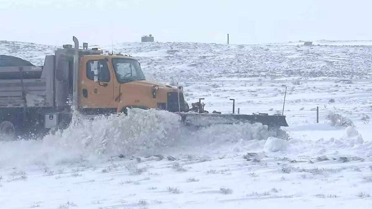
Overnight lows will fall into the 30s and low 40s, and more light precipitation will linger into tomorrow before today’s disturbance moves away. Some areas in central Montana could pick up more than 0.25 inches of precipitation through tomorrow evening, while many locations in north-central Montana will end up with less than 0.1 inches. In the mountains, a coating to a couple inches of snow is possible, with the highest totals in the mountains of southern Montana and Wyoming, where up to a foot of snow could fall.
Winter weather headlines are already in place for the mountain zones most likely to feel the impact. A Winter Storm Warning runs through 6 p.m. Thursday for the Absarokas and Beartooths, and a Winter Weather Advisory is in effect from 3 a.m. to 9 p.m. Thursday for the Bighorn and Pryor mountains.
The Beartooth Highway is also in the path of the snow. Snow is expected there tonight and tomorrow, and that could delay the road’s projected Friday opening.
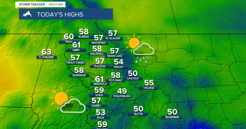
Thursday will still feel cool, with partly cloudy skies and highs in the mid to upper 50s and low to mid 60s, along with sustained winds of 5 to 20 mph. By Friday, high pressure takes over and brings a much friendlier forecast: partly to mostly sunny skies, mostly dry conditions and highs in the mid to upper 60s and low 70s. There could still be a couple stray afternoon showers or storms Friday and Saturday, but little to no wind is expected.
The warm-up continues through the holiday weekend. Saturday should reach the 70s and low 80s, Sunday the mid to upper 70s and low to mid 80s, and Monday the 80s and low 90s. Breezier weather returns Sunday and Monday, with sustained winds of 10 to 25 mph and occasional gusts that could approach 40 mph.
By Tuesday, cloud cover will increase again, followed by scattered showers and thunderstorms in the afternoon and evening. More showers and thunderstorms are expected Wednesday as an upper-level trough moves back into the state, bringing the wet pattern full circle after the brief stretch of holiday weekend sunshine.